| Metairie, 1955 |
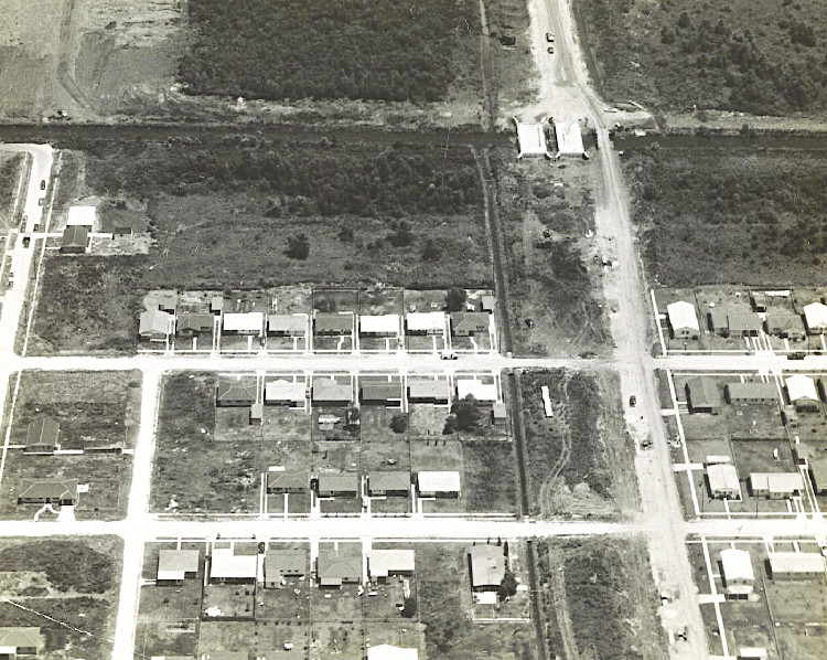
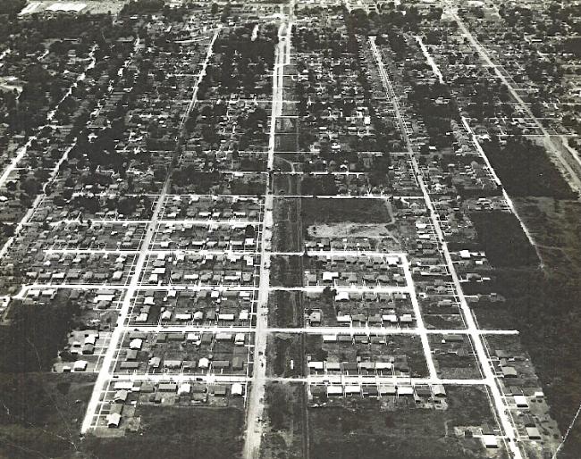
| We are so indebted to Pam Olivier for sharing these excellent aerial views of Metairie in 1955. Doesn't look quite the same, does it? A lot more traffic now, and a lot fewer empty lots! The man who took these shots was an aerial photographer for the Air National Guard, Ralph Lincks. He was a neighbor of Pam's family. I usually make the images smaller, but I wanted to include as much detail as I could, especially on the first one, so I left these fairly large. A huge thank you to Pam for sharing these photos. |
| These photos were taken on June 15, 1955. Pam's family lived on 39th Street, across the street from Ralph Lincks' family. Mr. Lincks made a special effort to capture this photo, with the milk truck parked directly in front of his house (across from Pam's family home). From Pam: "We lived two houses off Causeway Blvd. (then called Harlem Avenue) and close to what is now West Napoleon. You can see that Harlem was a dirt road on the right. The new bridges across the canal were being constructed. The proposed site for N. Causeway here was the area of land to the left of the dirt road. 39th was the last developed street. 38th Street was not even developed yet and from the canal all the way north to the lake was nothing - all swamp land!" |
| Continuing Pam's description: "In this photo, Schwegmann's Grocery compound on Labarre and Airline is in the upper left corner. The rest is all of Metairie. You can see the diagonal Metairie Road clearly below Schwegmann's. The older section in the top half has all of the trees, the newly developed area has hardly any trees. The two-tone patch of open land four streets up from 39th is the future home of Tharp-Sontheimer Funeral Home. To the far right, bottom, is now where Archbishop Rummel High School is." |
| The link to this page is: http://old-new-orleans.com/NO_Metairie_1955.html |