
| Plaquemines Parish, Louisiana |
| In 1699, Pierre Le Moyne d'Iberville entered the mouth of the Mississippi River and proceeded upstream to a place on the west bank, about sixty miles below the future site of New Orleans. The day was March 3, the date of Mardi Gras in France. |
| Photos on this page are courtesy of The Toronto Star Infrogmation @ Wikimedia Commons and Library of Congress. |
| The link to this page is: http://old-new-orleans.com/NO_Plaquemines_Parish.html Other pages you might enjoy: Pilottown: The Last Outpost Mary Plantation: The Oldest Home in Plaquemines Parish Woodland Plantation: Home of Southern Comfort's Iconic Label Back to Old New Orleans Whispers - Home |
| For that reason, he named the spot Point du Mardi Gras and called the nearby tributary Bayou Mardi Gras. So, it happened that, in what would eventually become the state of Louisiana, d'Iberville's first point of landing was in what is now Plaquemines Parish. |
| Plaquemines Parish has been welcoming travelers who enter the United States by way of the Mississippi River for a long time. It's here in Plaquemines that ships from all over the world, upon entering the river, first encounter the flag of the United States. |
| The parish, which adjoins Orleans Parish to the north, is a long sliver of ribbon, straddling the Mississippi River, surrounded by water - in fact, much of it made up by water. When I looked at an image of the area taken from space recently, I recalled a quote by Harnett T. Kane in Bayous of Louisiana: |
| "It is a place that seems unable to make up its mind whether it will be earth or water, so it compromises." |
| There wasn't much compromise when Hurricane Isaac came through in September, 2012. The water mostly won. With Louisiana's wetlands disappearing at an alarming rate (as of this date in October, 2012, Louisiana has lost more than 31,000,000 square yards of land just since January, 2012), the state's southern parishes are more vulnerable to storm surges - none more so than Plaquemines, jutting bravely, as it does, out into the Gulf. |
| Plaquemines Parish has a long and interesting history. Its residents, many of whom have families going back more generations than some places in the nation have even existed, don't relinquish their land willingly. As Cain Burdeau said recently, "Ever since the Mississippi River laid down this strip of silt, wind and water have conspired to drag it into the sea. And, for almost as long, the oystermen, river pilots and others who call it home have refused to let it go." |
| Vintage Photos of Plaquemines Parish |
| Pilottown - For over a hundred years, Pilottown has been the last manned outpost on the Mississippi River. It is headquarters for the river pilots, who are required to take over ships and steer them through the dangerous and unpredictable river currents between Pilottown and the port of New Orleans. Once a thriving community, only one of the pilots' groups remains, along with a few lonely houses, most people now preferring less remote locations upriver. Above photo, ca. 1946. |
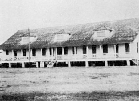
| Above & below: Old Quarantine Station - during Yellow Fever outbreaks, people who were ill were removed from the ships entering the river and held here. Photos from 1950. |
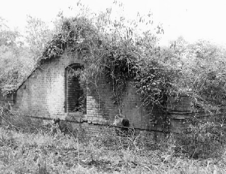
| Ruins of Fort St. Philip - The first fort was built on this site on the river by the Spanish in the 1700's (San Felipe). That fort saw a 9-days' battle with the British during the War of 1812. The next fort was constructed at the urging of Andrew Jackson as a defense for New Orleans and the river. This fort saw s 12-days' battle during the Civil War. The fort was declared a National Historic Landmark in 1960. Privately owned, it is now in a bad state of deterioration. |
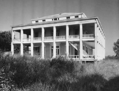
| Many people believe that all of the River plantations were built north of New Orleans, since that's where most of the survivors are. But more than 60 plantation houses in Plaquemines and St. Bernard Parishes once lined the River between New Orleans and the Gulf. Of these, only a handful remain and some of these are in bad condition. The home above belonged to Judah P. Benjamin, who, also, owned houses in New Orleans. This home, called "Belle Chasse," is no longer standing; photo, ca. 1938. |
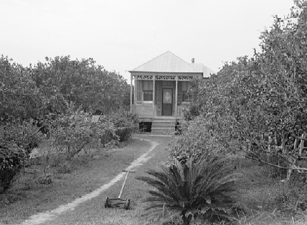
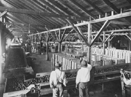
| Above, home of an orange grower in Boothville in 1938. Plaquemines Parish has a rich history in the citrus industry. In fact, its name comes from the Mobile Indian name for persimmon, "plakamin." Below, an orange-packing plant in Buras, ca. 1930's. |
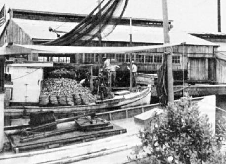
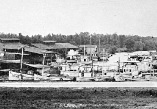
| Above, oystermen, 1950 - Plaquemines Parish is home to a huge seafood industry, exporting millions of pounds of oysters, shrimp and fish annually. Hurricane Katrina, in 2005, wiped out about half of the shrimping and shellfish fleet. The BP oil spill in 2010 did further damage. But the people of Plaquemines are resilient and the industry is rebounding. |
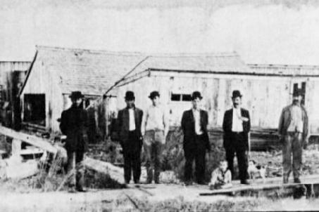
| Men stand in front of an oyster shucking shed in the community of Oysterville in the 1940's; among those pictured, Frank Lobrano, Sr. and his son, Jay. |
| Oyster packing plant of F. K. Devitt on the Caernarvon Canal, ca. 1940's. |
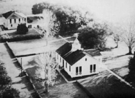
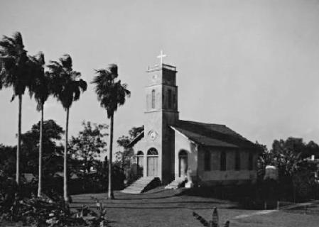
| St. Thomas Catholic Church in Pointe a la Hache, 1930's. |